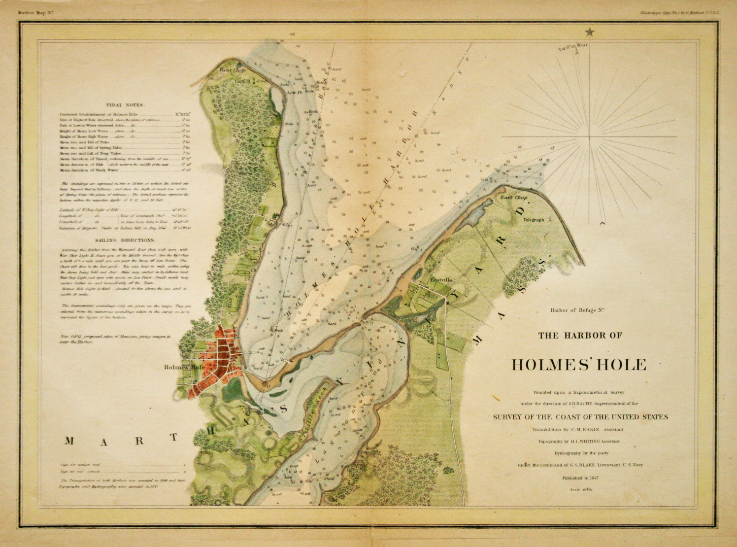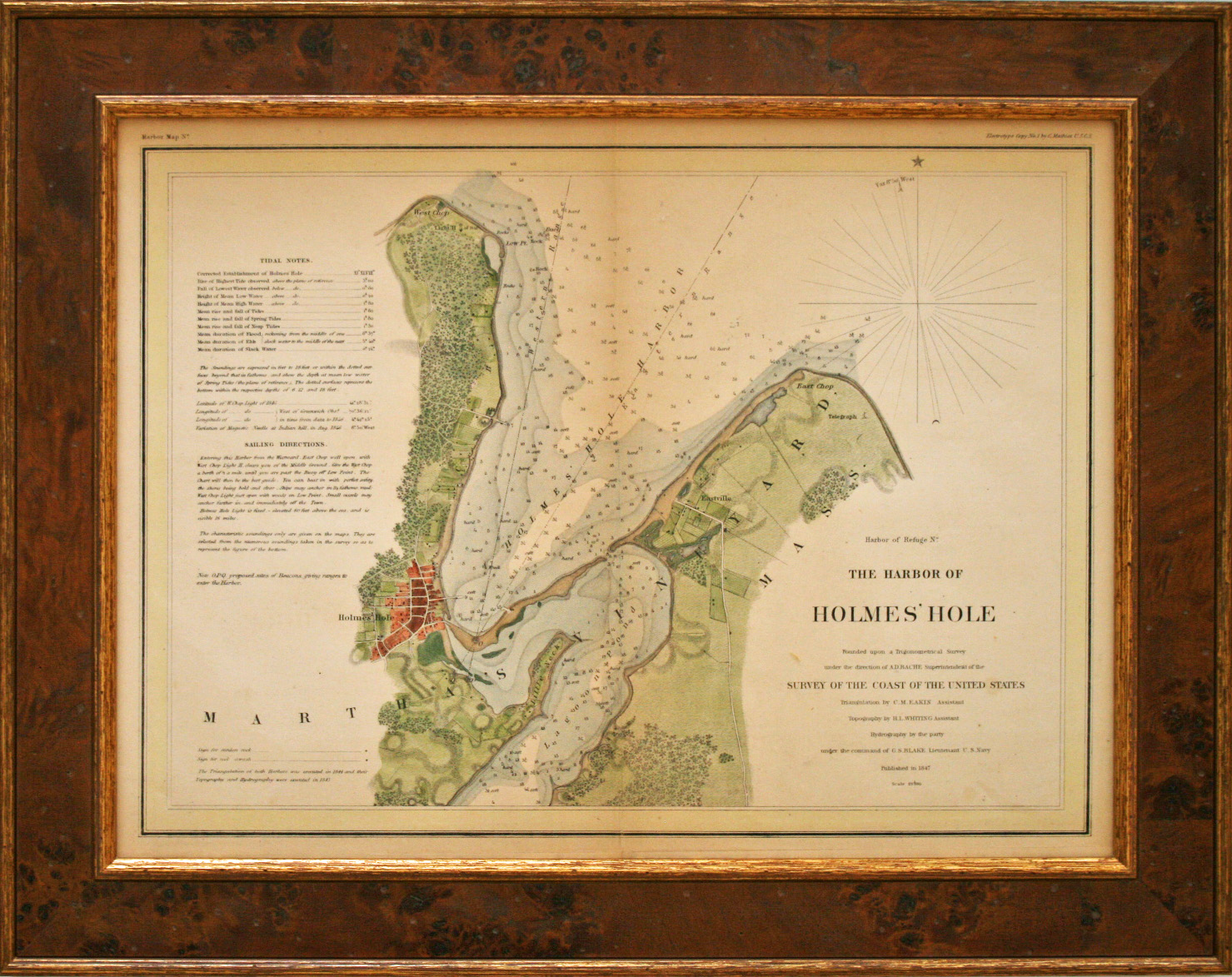
This original nautical chart of The Harbor of Holmes’ Hole, dated 1847, is from the U.S. Coast Survey collection. These charts were intended for navigational purposes by sea captains and included information relative to tides, soundings, lighthouses, sailing directions with noted danger areas and other pertinent data. This chart is tinted good condition. The framing is done to conservation standards with an attractive burl wood frame.
Harbor of Holmes Hole 1847
by U.S. Coast Survey
Antique Nautical Chart, 15" x 19" Framed, $885