When George Washington appointed the first military engineer during the American Revolution, he set in motion the beginnings of the U.S. Army Corps of Engineers. The Corps of Engineers was established as a permanent military branch in 1802, with the understanding that it would cover both military construction as well as civil projects. Over the years, it has expanded and adapted to the changing needs of the country, aiding in national defense, expansion, and reconstruction.
When George Washington appointed the first military engineer during the American Revolution, he set in motion the beginnings of the U.S. Army Corps of Engineers. The Corps of Engineers was established as a permanent military branch in 1802, with the understanding that it would cover both military construction as well as civil projects. Over the years, it has expanded and adapted to the changing needs of the country, aiding in national defense, expansion, and reconstruction.
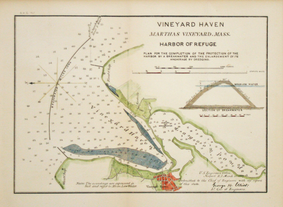
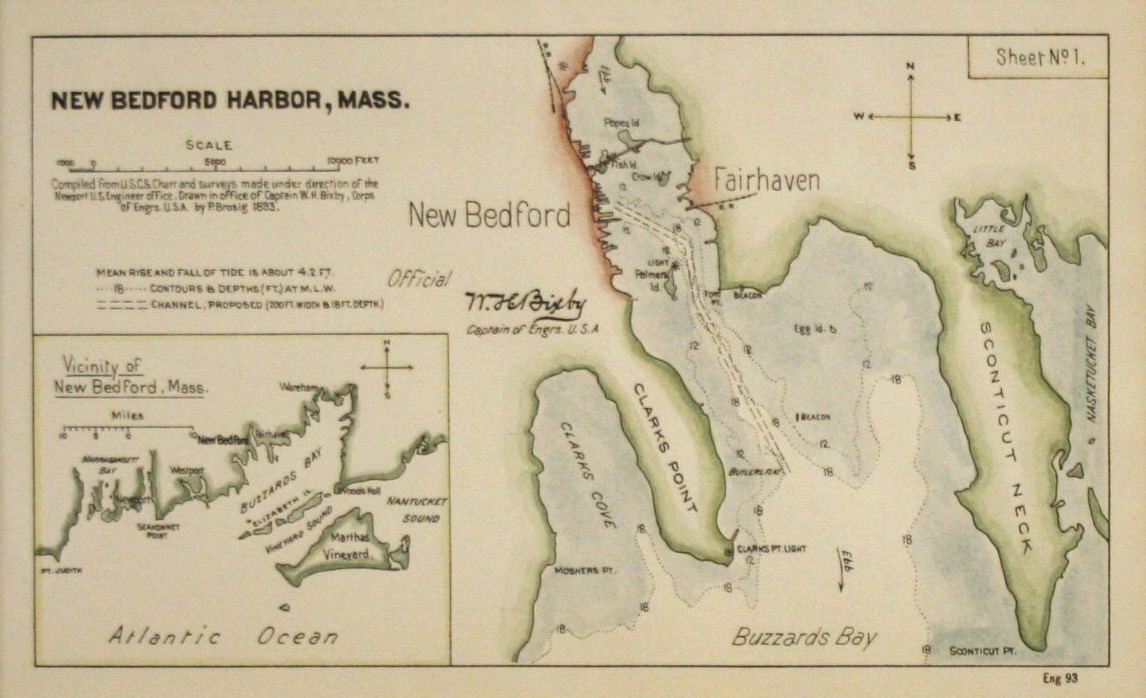
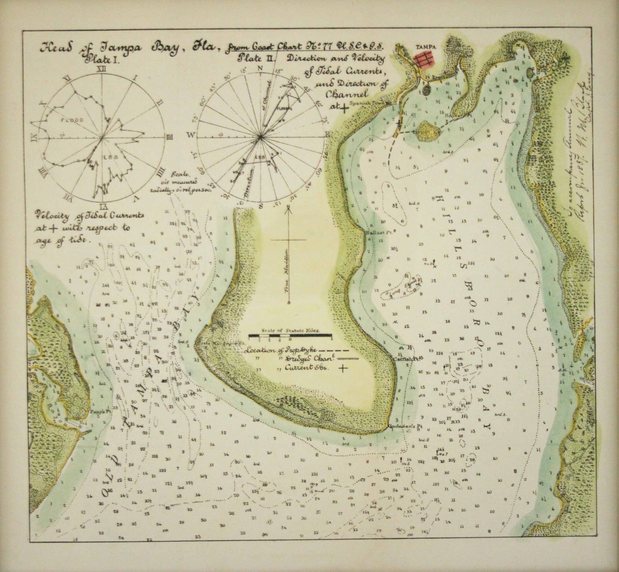
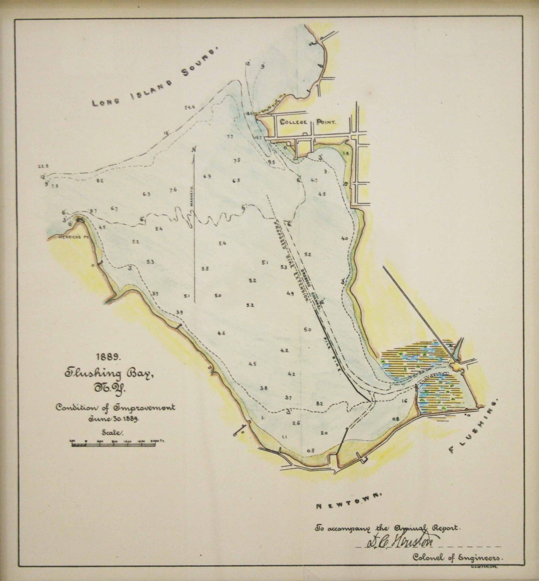
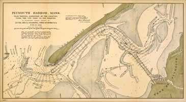
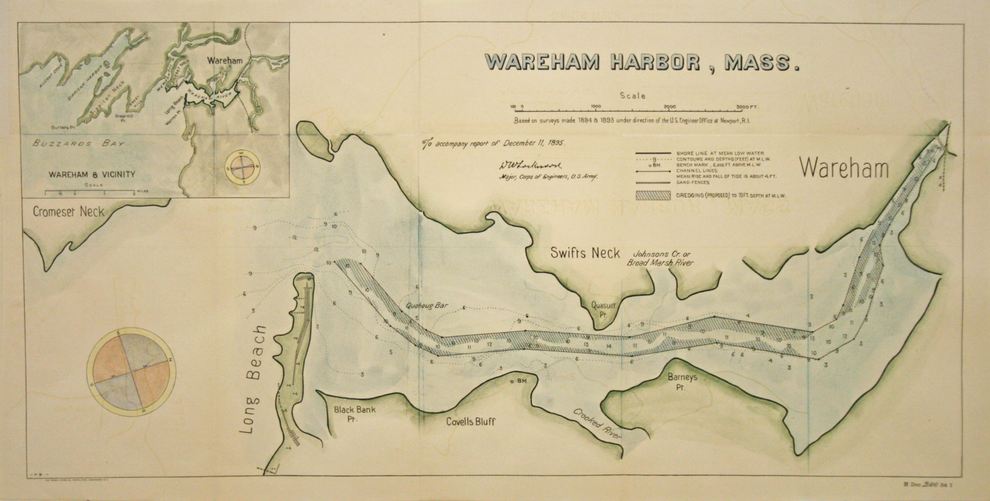
The 19th Century was a notably dynamic time in American history, and as the nation pushed westward, new territories had to be explored, mapped, and managed. The Corps supervised the construction of coastal fortifications and mapped much of the American West with the Corps of Topographical Engineers, which enjoyed a separate existence for 25 years (1838—1863). The topographical engineers or “Topogs,” reported to a separate Topographical Bureau in the Engineer Department. As surveyors, explorers, cartographers, and construction managers, the topographical engineers helped open the nation’s interior to commercial development and settlement.
As a whole, the Corps of Engineers – specifically the Corps of Topographical Engineers – improved travel across the country by conducting field surveys and mapping out roads, rivers, and railways. By constructing and documenting everything from harbors and jetties to monuments and levees, the Corps holds an integral place in the formation of the United States we see today.