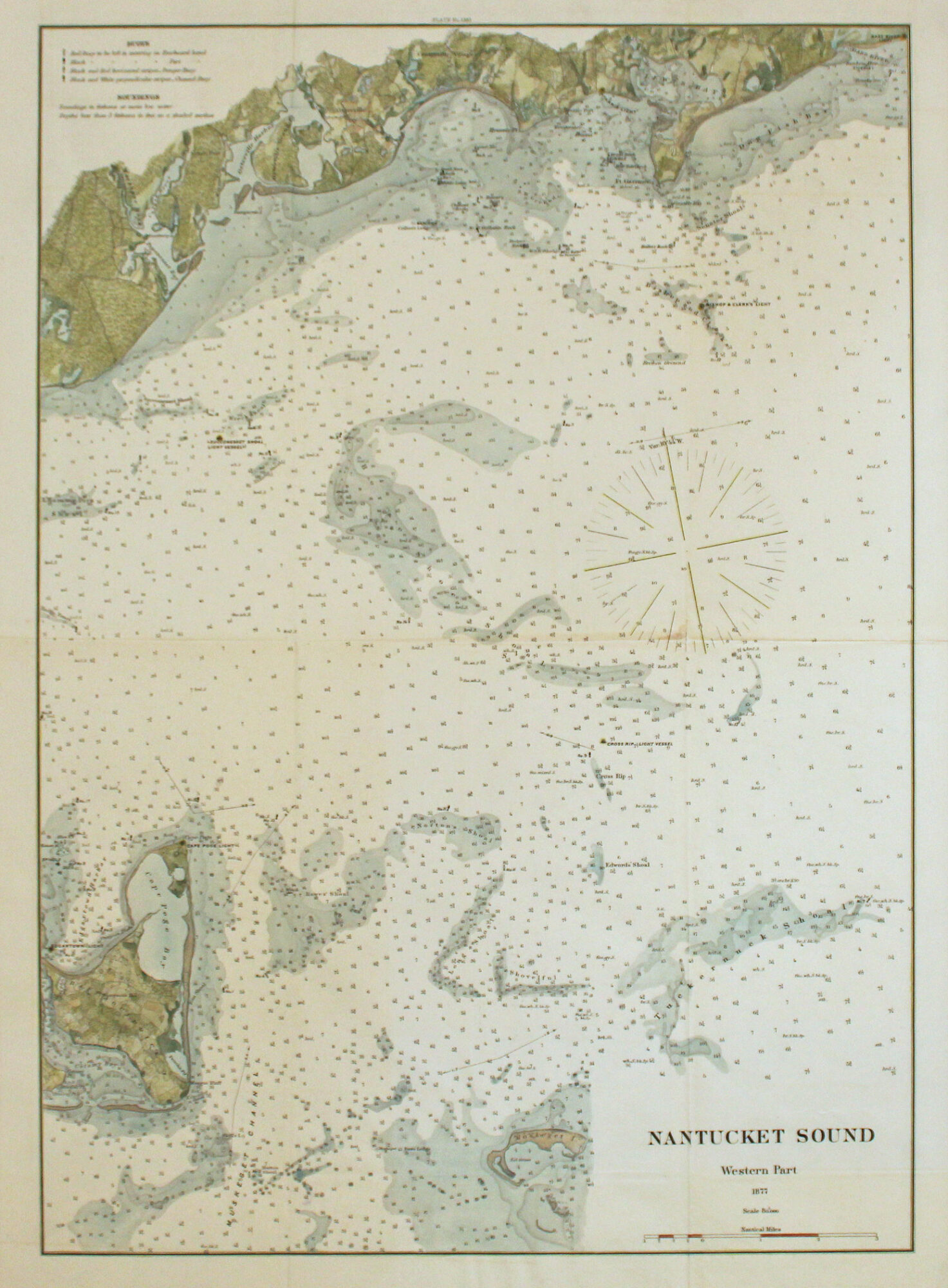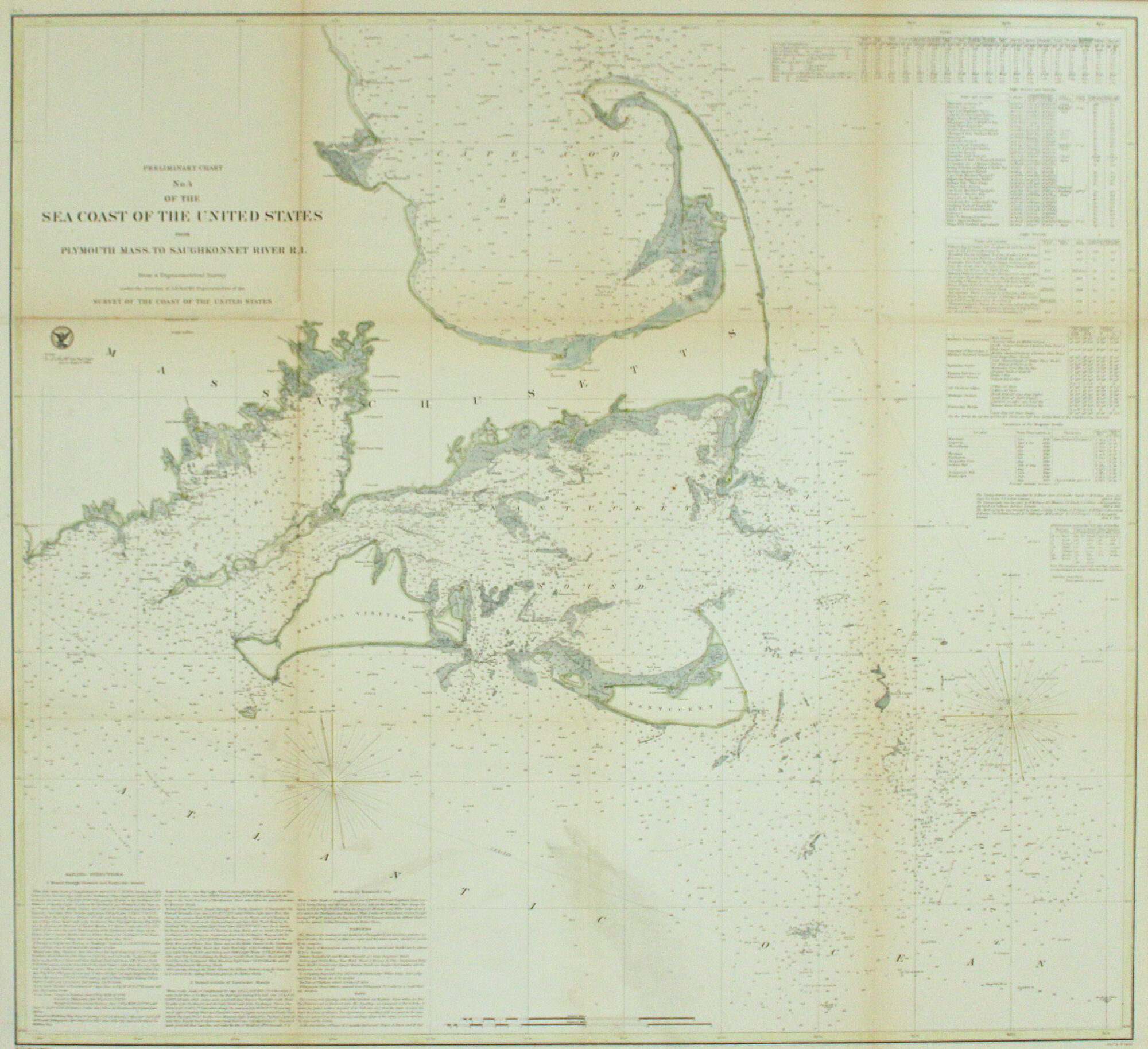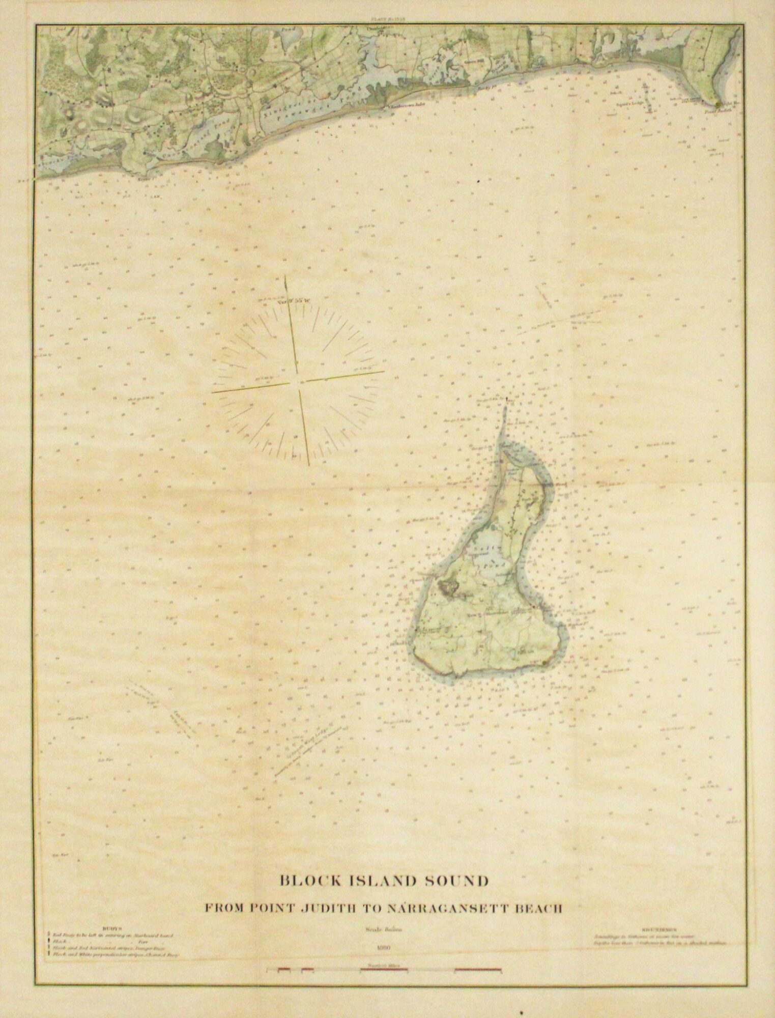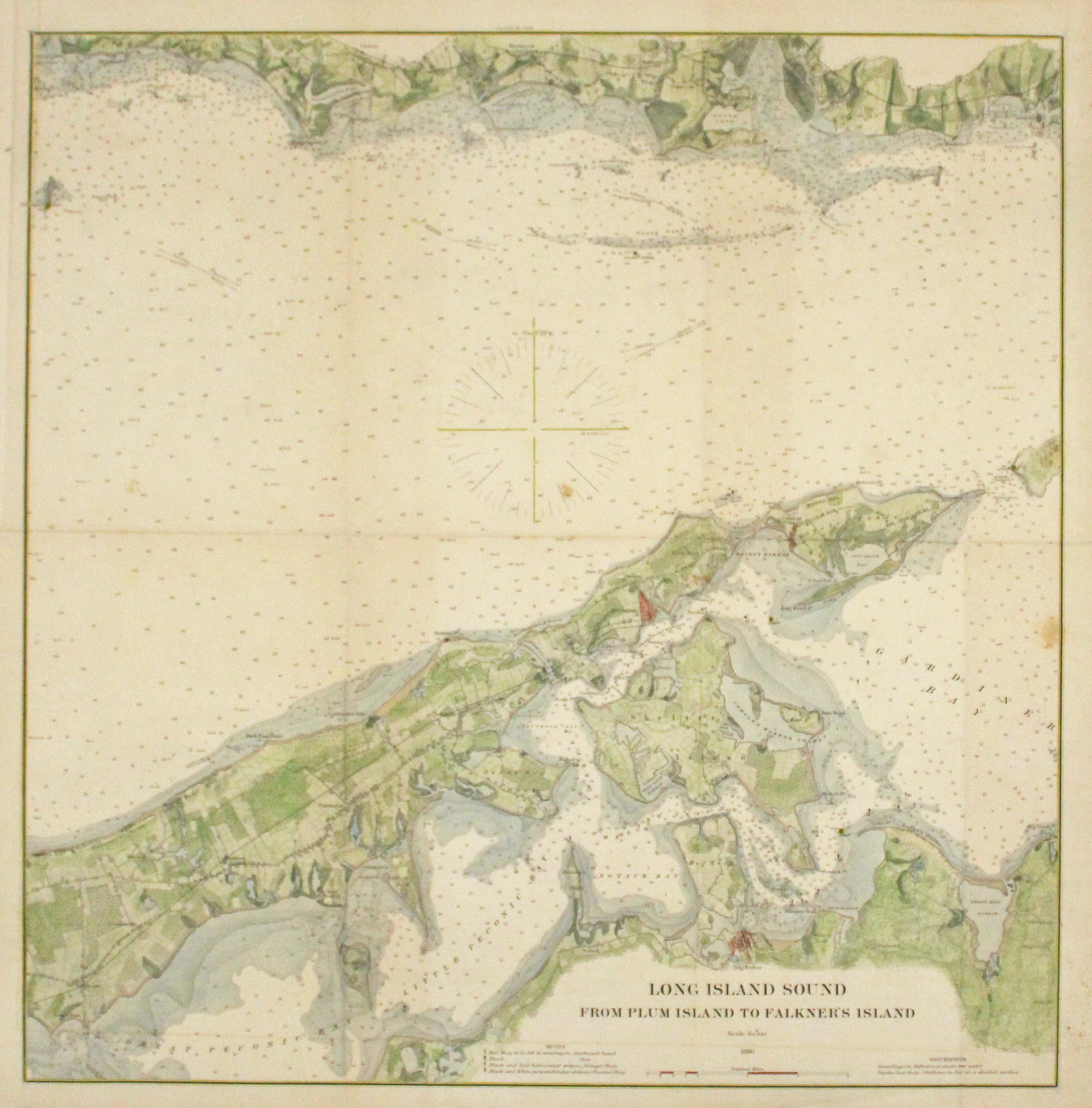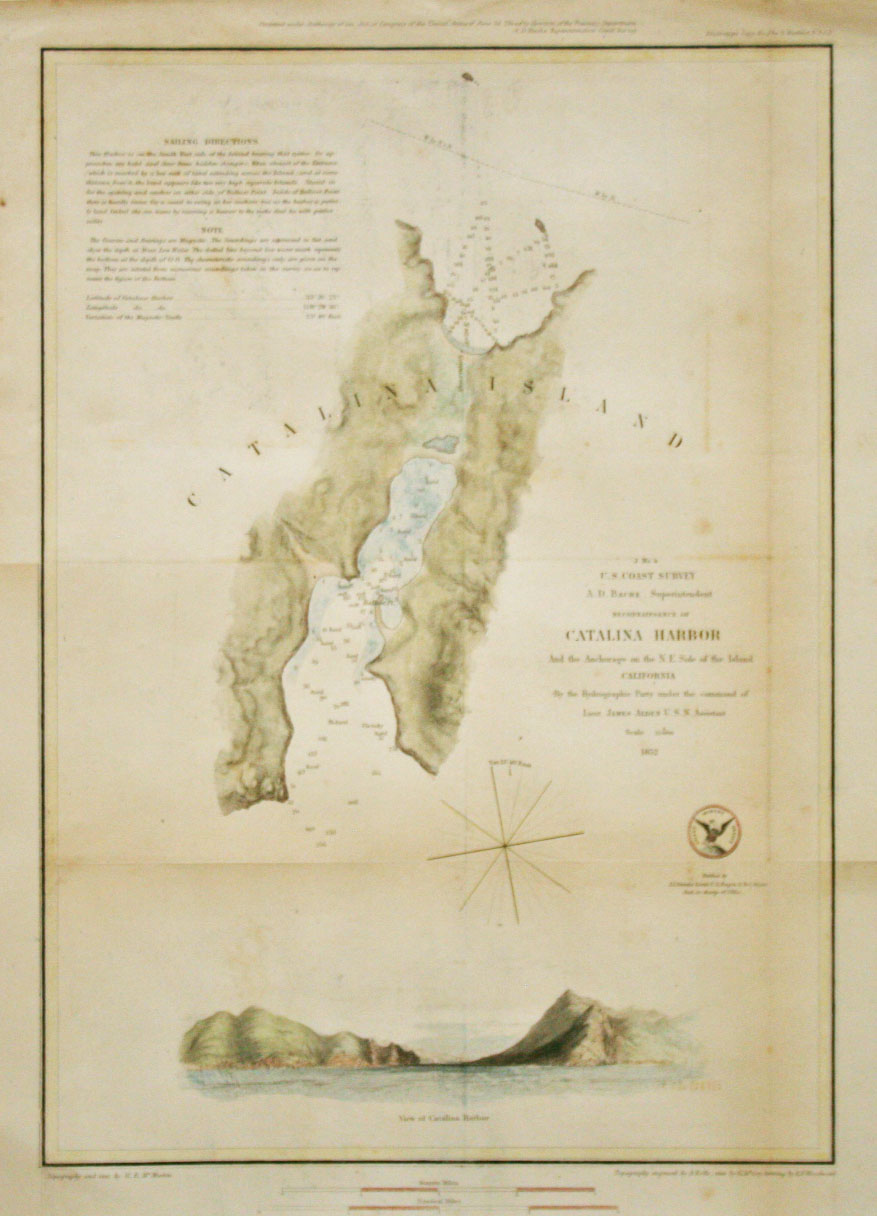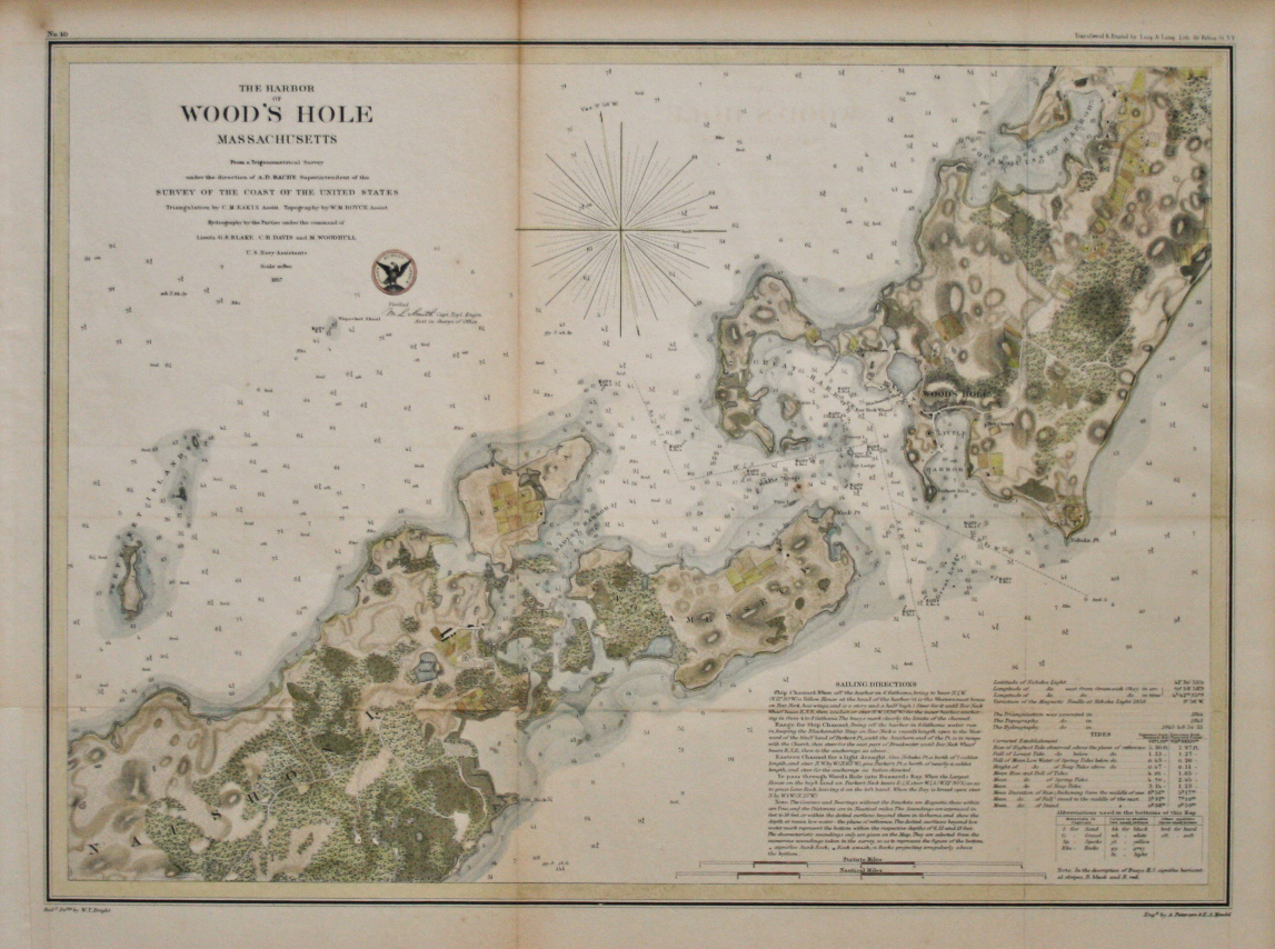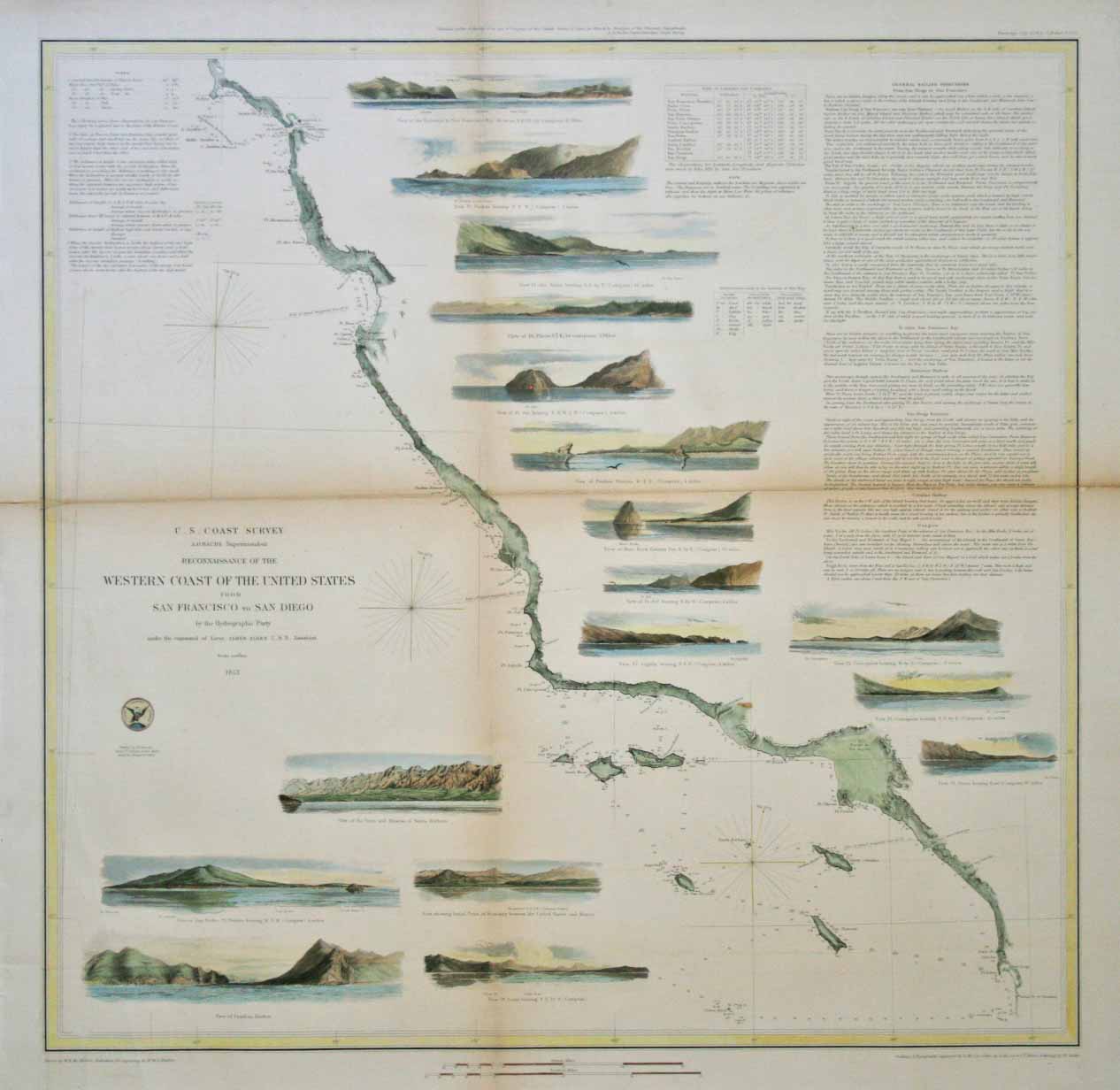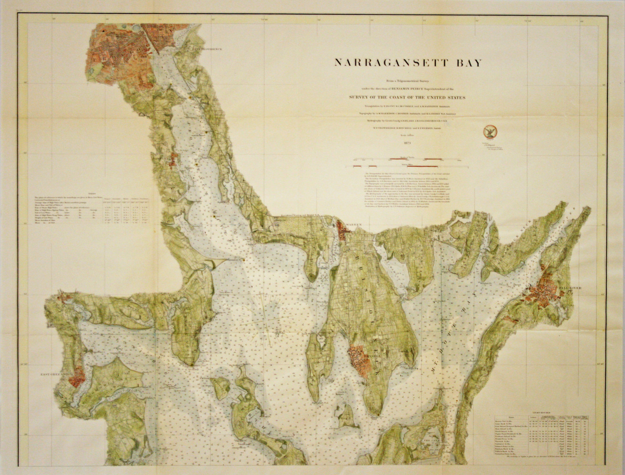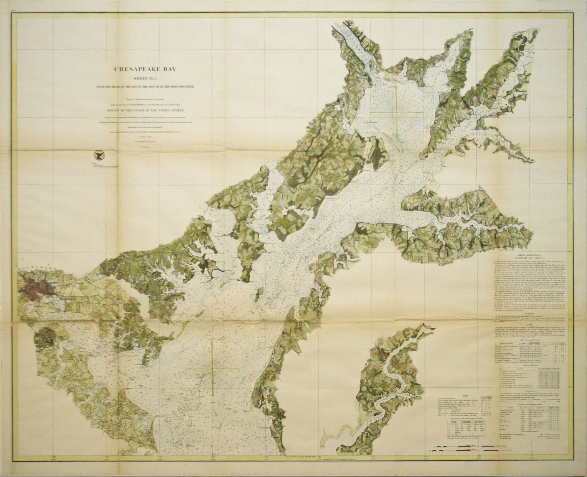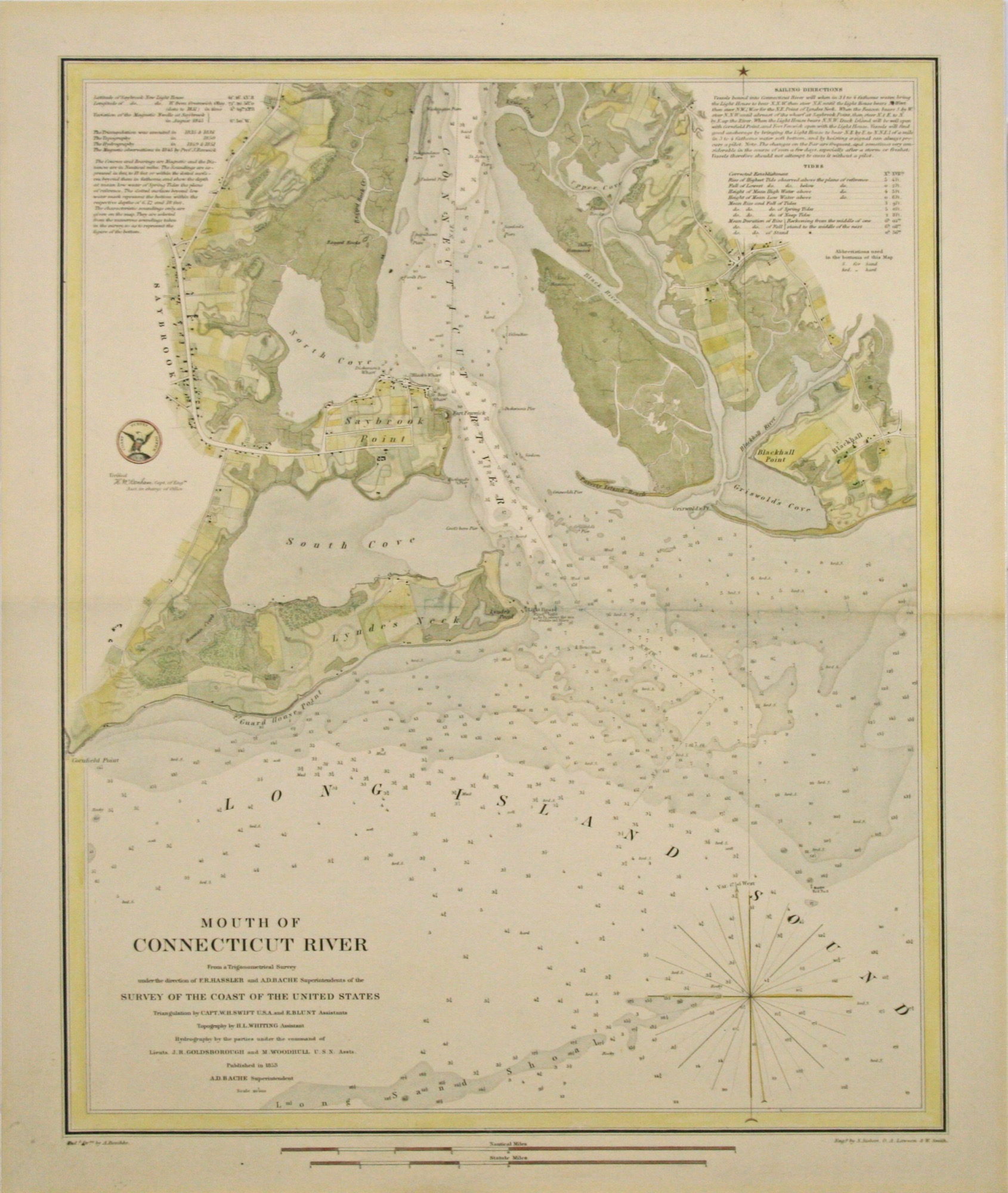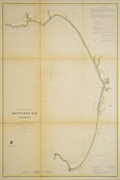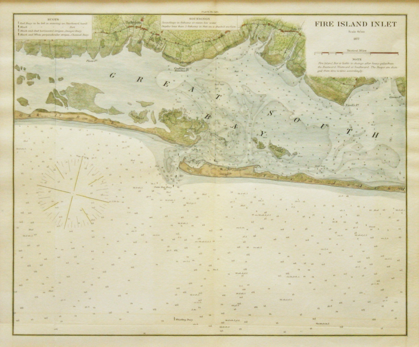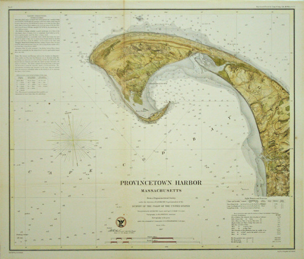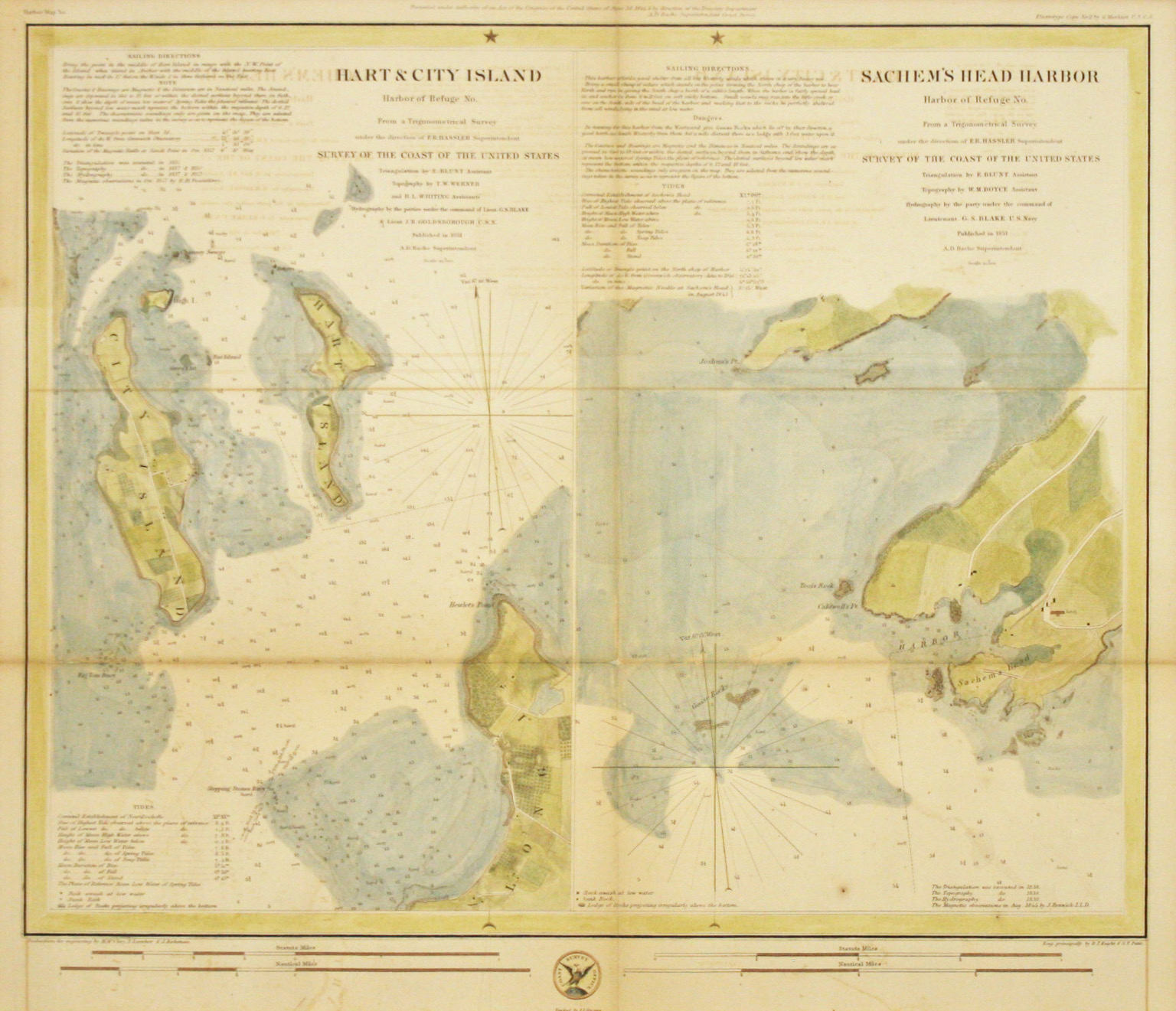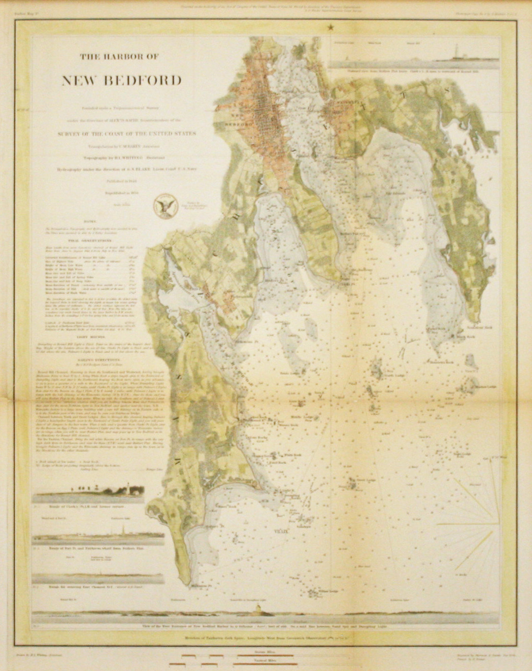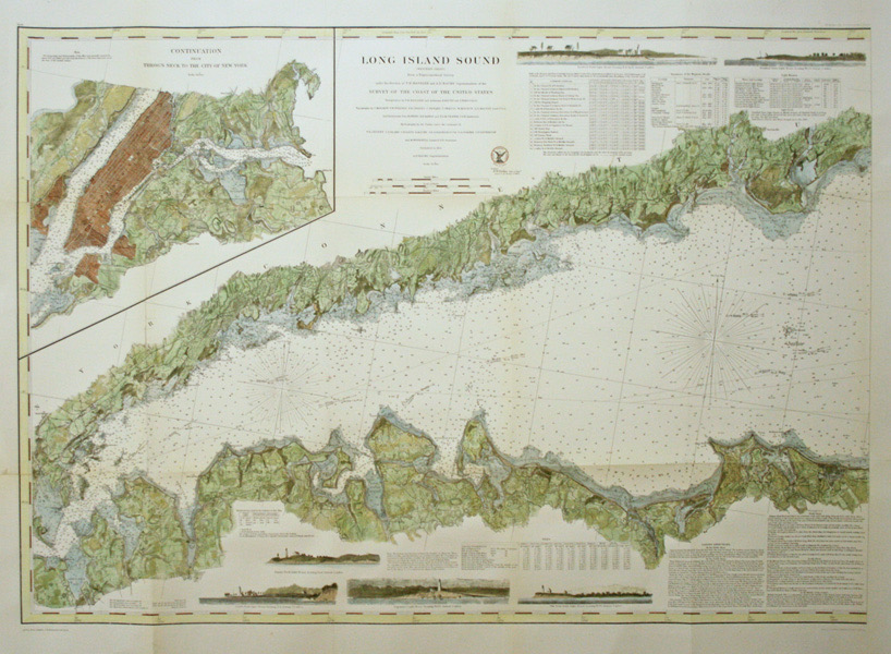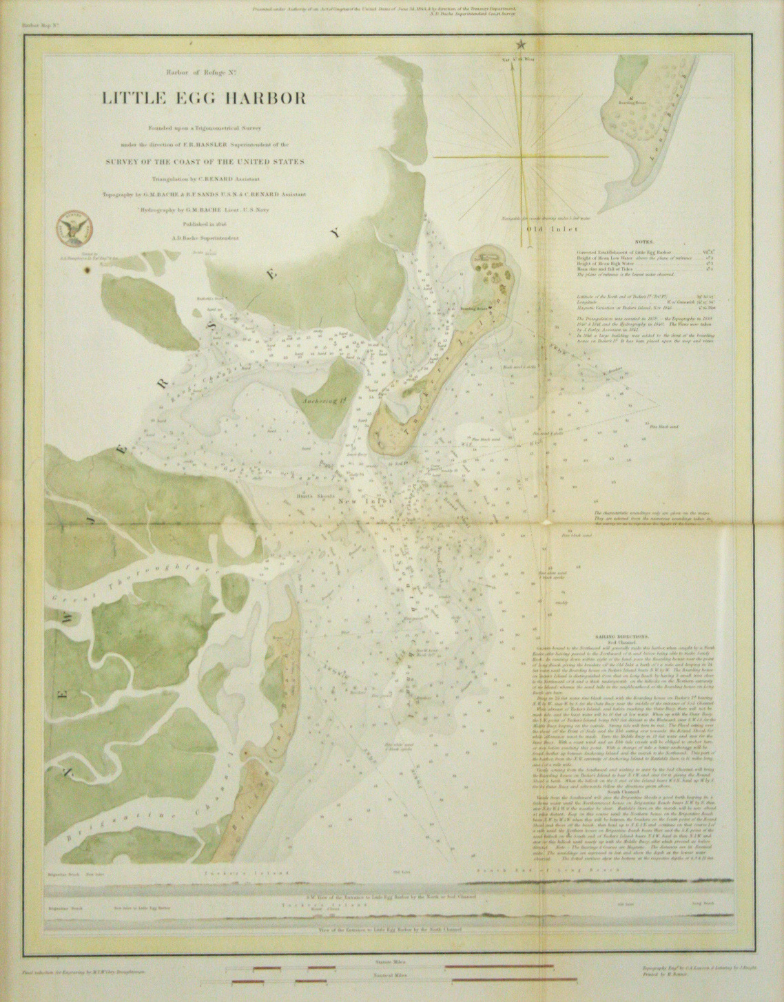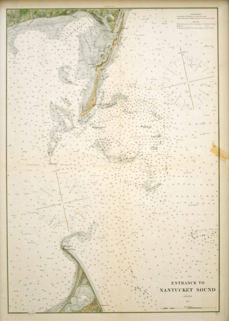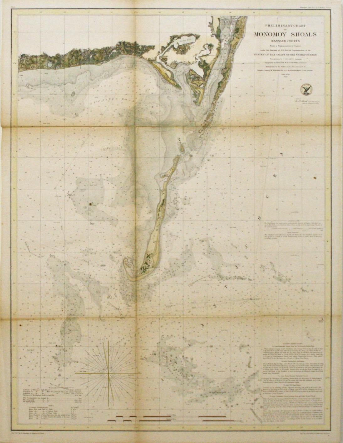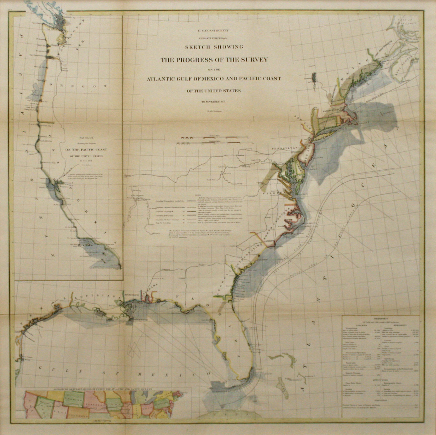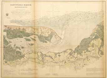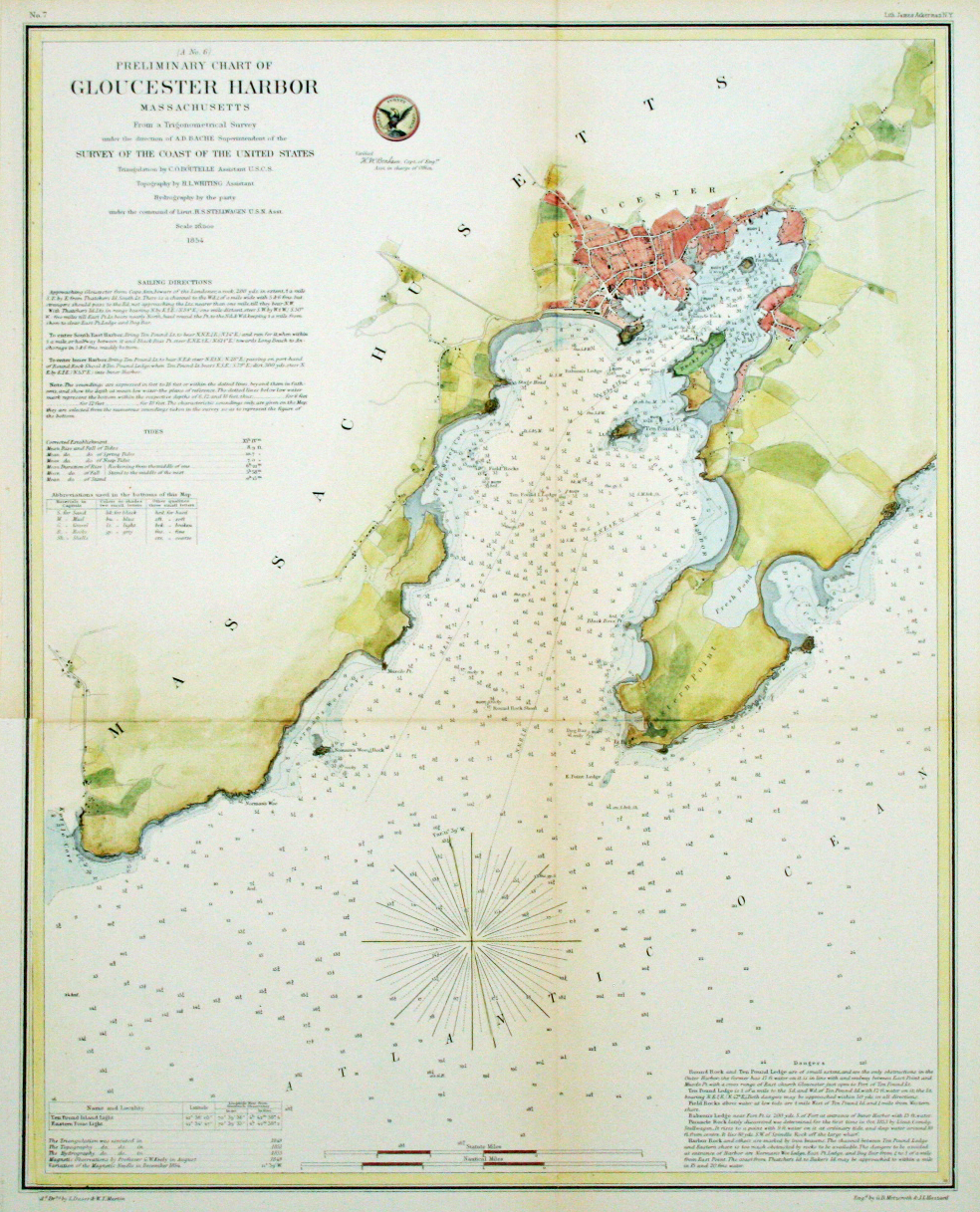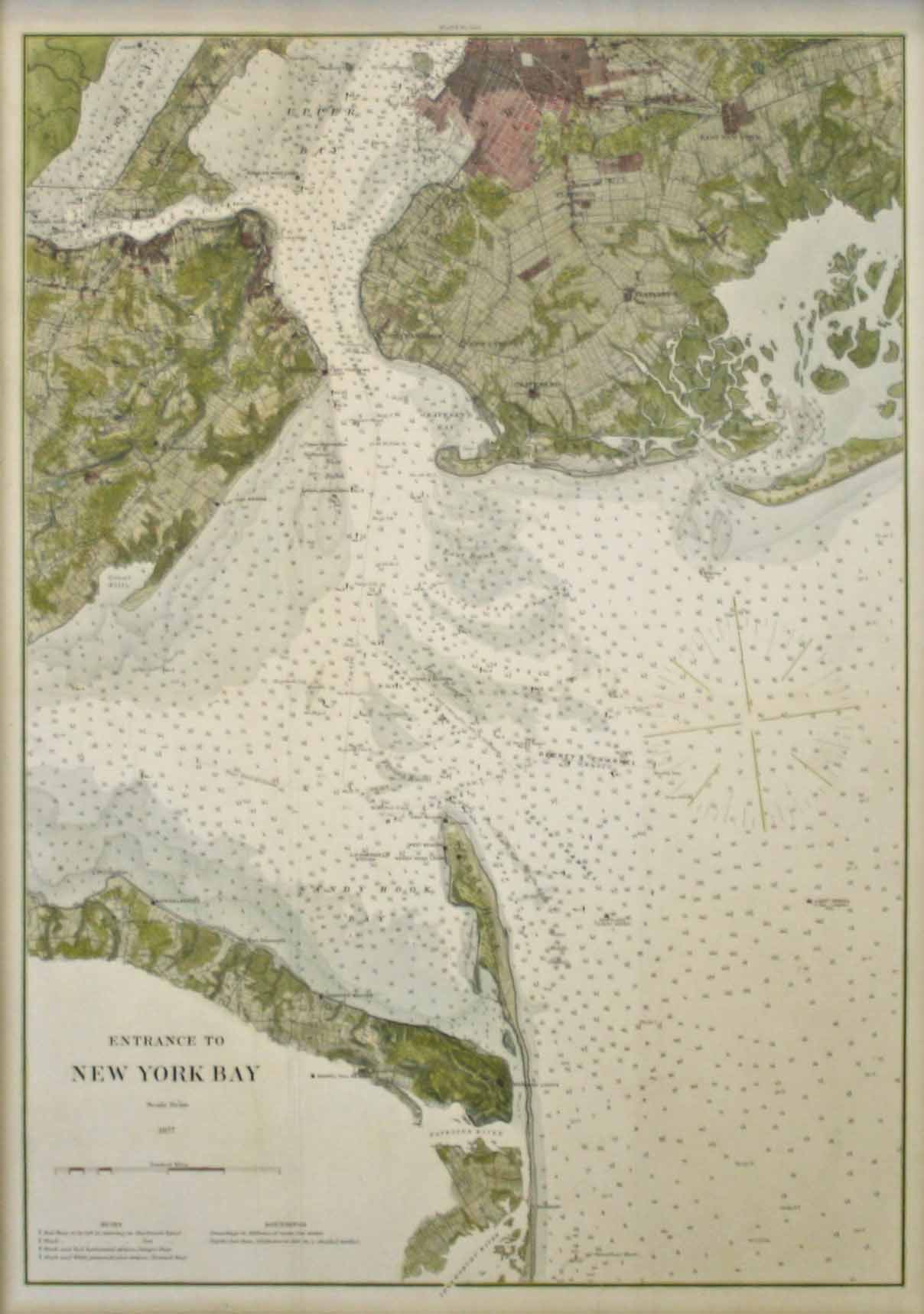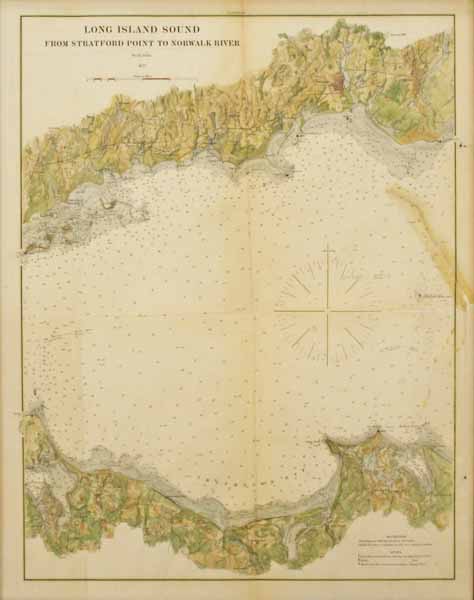
The years between the end of the American Revolution and the beginning of the Civil War were pivotal ones in the development of American coastal charting. The country was expanding, the population was resettling and the coast lines were lengthening. Industrialization in the north east encouraged the export of manufactured goods and the import of raw materials and with the discovery of gold in California, the country had grown from one coast to the other and maritime traffic had increased significantly.
The years between the end of the American Revolution and the beginning of the Civil War were pivotal ones in the development of American coastal charting. The country was expanding, the population was resettling and the coast lines were lengthening. Industrialization in the north east encouraged the export of manufactured goods and the import of raw materials and with the discovery of gold in California, the country had grown from one coast to the other and maritime traffic had increased significantly.
With this increased traffic came larger and faster sea vessels and an urgent need for better coastal charts to assist in navigating the coastal areas of the country. Early surveys, both public and private, were considered extremely inaccurate and imperfect with reference to data collection. The need for organized accuracy caught the attention of a group in Philadelphia called the American Philosophical Society. This group included such notables as Robert Patterson, John Vaughn, Albert Gallatin and Thomas Jefferson.
During the late 1780’s, a Swiss mathematician residing in Philadelphia named Ferdinand Hassler and also a member of the American Philosophical Society organized a new method of data collection, drawing upon the improving technology in various American scientific fields. His purpose was to determine the geographical position of certain prominent points along the coast by astronomical and trigonometrical methods, and to connect these points with lines so as to form a basis upon which the nautical survey of the channels, shoals, and shore approaches could be made.
And it was his efforts that became the accepted method for the U.S. Coast Survey and all future surveys. In 1807, a “Survey of the Coast”, which was to include the area from Maine to Georgia, was authorized through an Act of Congress and then President Thomas Jefferson. This was to become America’s first physical science agency and it has a long history as the oldest scientific organization in the United States.
Hassler was named the first Superintendent of the Coast Survey and held that position from 1816 to 1818 then again from 1832 to 1843. During his time, he imbued the organization with love of “truth” and unswerving compromise with the twin principles of accuracy and precision. His motto was: “It is the duty of every man to be honest and to do good.”
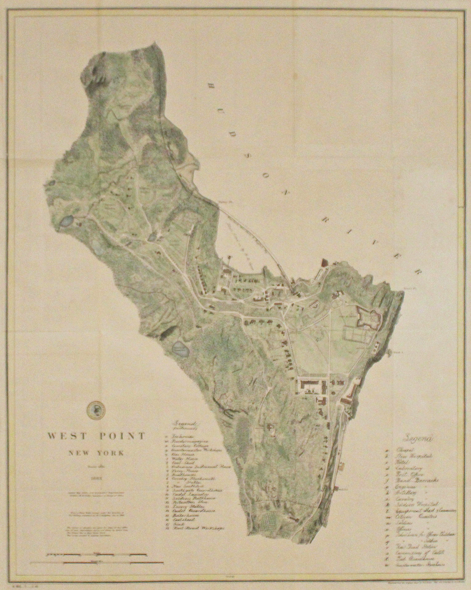
The various maps and charts of the Coast Survey were created by geologists, meteorologists, astronomers and topographers, each highly trained in this new scientific discipline and with an unheard-of attention to detail. These men and women (the Coast Survey hired women professionals as early as 1845) helped push back the limits of astronomic measures, designed new and more accurate observational instruments for sea and land surveying, developed new techniques for the mathematical analysis of the mountains of data obtained by the field parties, and further refined techniques of error analysis and mitigation. Storms, mountains, dust, mud, deserts, wild beasts, heat and cold; all were the companions of the Coast Surveyors. They engaged in a great physical adventure which is little known and little understood.
Following Hassler’s death in 1843, Alexander D. Bache, a great-grandson of Benjamin Franklin, took over as superintendent of the U. S. Coast Survey and using his profound knowledge of the American political scene, molded it into the ‘first great science organization of the U.S. Federal Government’.
As a result of Hassler’s radical concepts, and Bache’s dedication to the elevation of American science in the world, vast improvements were made in the American fields of geographic exploration, harbor design, printing, error-analysis, national defense and more.
In 1878, the U.S. Coast Survey was reorganized as the U.S. Coast and Geodetic Survey to accommodate topographic, as well as, nautical surveys. Today the Coast Survey is part of the National Oceanic and Atmospheric Administration or NOAA.