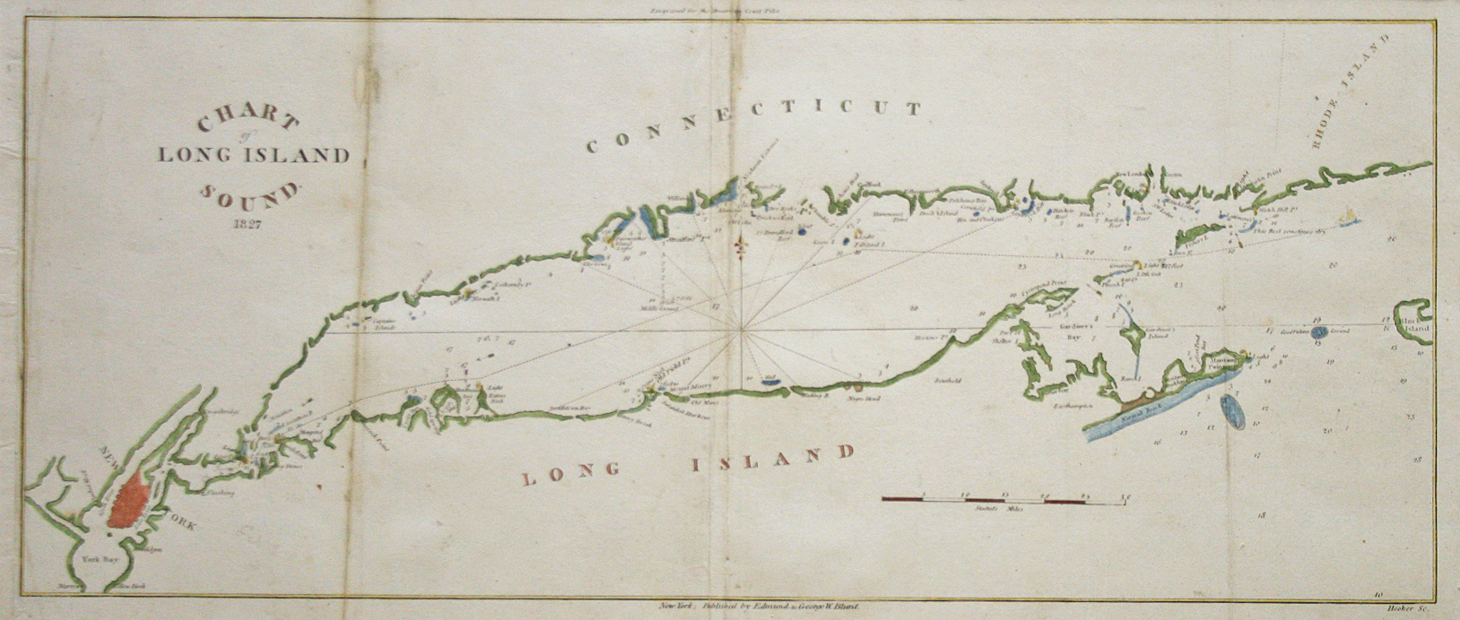
Edmund March Blunt (1770-1862) was a newspaper publisher, printer, and bookseller from Newburyport, Massachusetts. His first chart was Captain Paul Pinkham’s George’s Bank Including Cape Cod published in 1797. Blunt’s son Edmund (1799-1866), who was his namesake, surveyed for him between 1828 and 1830, and the pair published several series of charts of the Atlantic coast during the following years.
Edmund March Blunt (1770-1862) was a newspaper publisher, printer, and bookseller from Newburyport, Massachusetts. His first chart was Captain Paul Pinkham’s George’s Bank Including Cape Cod published in 1797. Blunt’s son Edmund (1799-1866), who was his namesake, surveyed for him between 1828 and 1830, and the pair published several series of charts of the Atlantic coast during the following years.
The Blunt firm also published charts of distant areas where Americans traded. Charts of the Caribbean provided special coverage of Cuba and the Windward Passage. Other locales published included South America, the River Plate, the North and South Atlantic, Bermuda, Labrador, the Cape Verde Islands, the English Channel, the Pacific and Indian Oceans; each recognizing the foreign sources used.
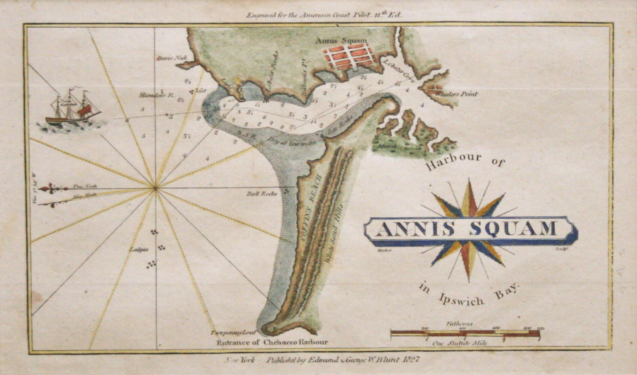
In addition to charts, the Blunt firm published maritime books and also financed and participated in surveys of hazardous areas. He and his son Edmund, then only sixteen, explored and surveyed New York Harbor and the adjacent coasts. In 1819 and 1820, young Edmund and his brother George William accompanied a survey group to the Bahama Bank in the sloop Orbit. In 1825, Edmund did survey work in Nicaragua for a canal across the isthmus.
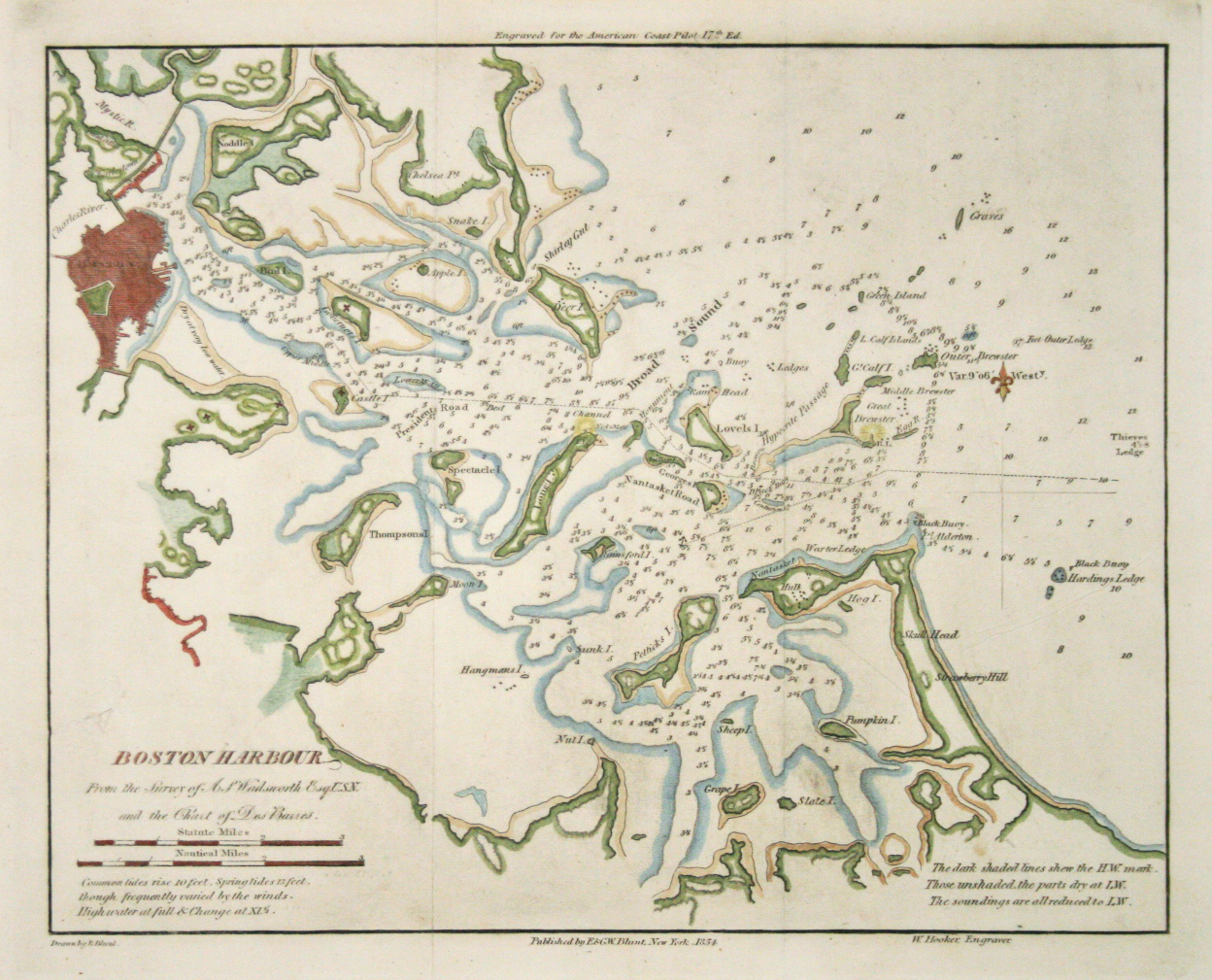
George William Blunt (1802-1878), son of Edmund March Blunt, established himself in a similar business as his father in New York and published the numerous editions of Bowditch’s Navigator, Blunt’s Coast Pilot and nautical charts of the world. The copper plates of these maps and the copyrights to the Navigator and Coast Pilot were later purchased by the U.S. Hydrographic Office when that bureau began its publication work. From 1833 until his death, Blunt was first assistant in the U.S. Coast Survey. He also served for 32 years on the Board of Pilot Commissioners and did much to put through needed reforms in the U.S. Lighthouse Service.